GPS trackers such as the Beeline Big Red Bee have been proven very helpful in the past. However, we noticed decoding problems once the rocket had landed. Although the beeps and blips of the transmitter could still be heard, the poor signal could not be decoded. Furthermore, the transmitted GPS coordinates could only be decoded by radios equipped with an APRS decoder.
To overcome these problems, I developed a GPS transmitter that transmits the coordinates and altitude using a speech synthesizer. Even with poor reception, the voice can still be heard. In addition, anybody in the field can now pick up the signal using a standard radio. In a recent upgrade, both APRS and spoken coordinates and altitude are transmitted by the Talky GPS. Furthermore, individual units can be identified by a unique call sign followed by a message number. This feature allows for full storage of the flightpath in a Kenwood TH-D7 radio. This played a crucial role in the recovery of the Chiron2 rocket in April of 2017.
The board uses a low power Atmel 328p microcontroller and a 1 Watt DRA818U UHF radio module. The system monitors the voltage of the lipo battery and will transmit with longer intervals when battery power is becoming low.
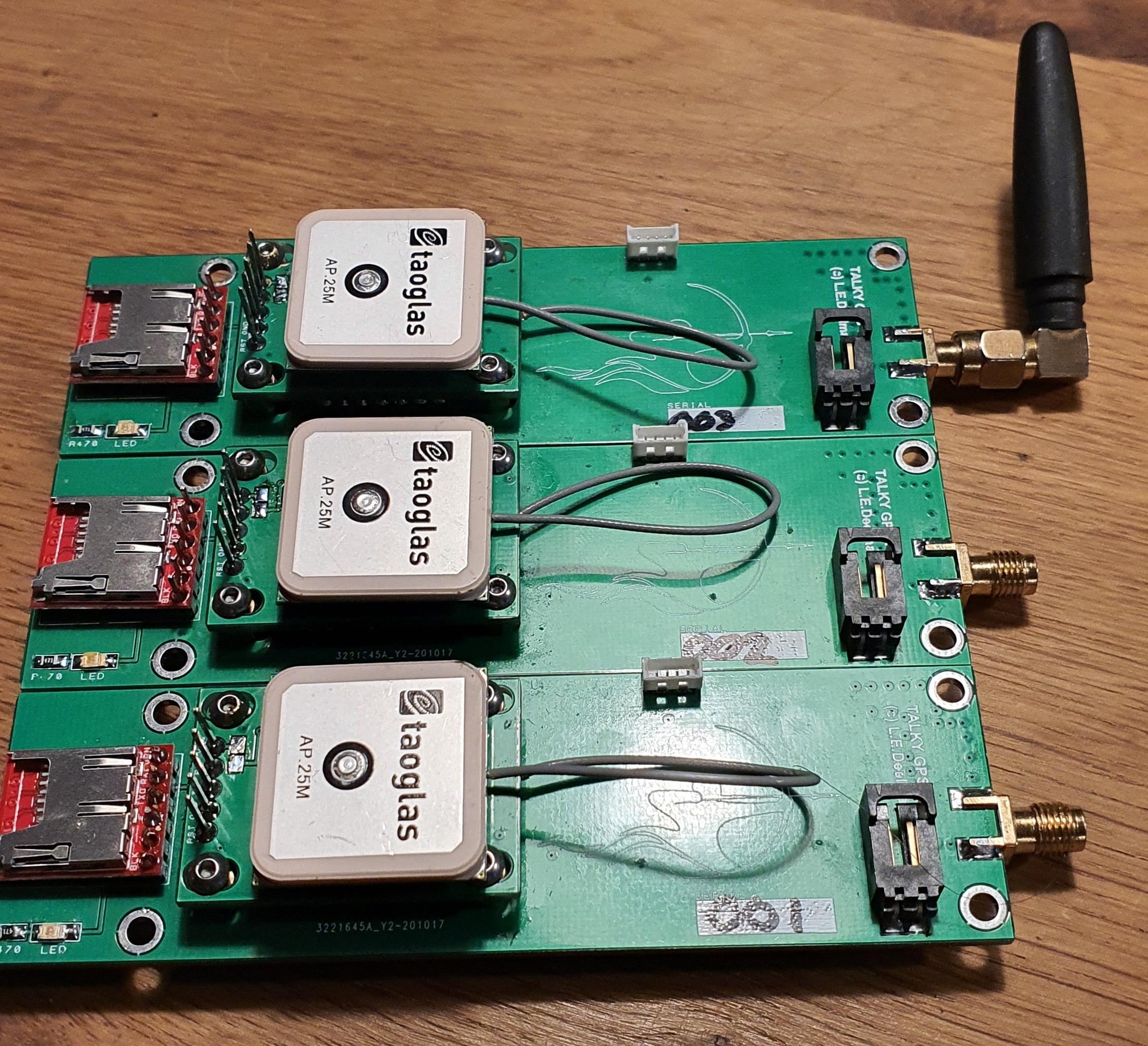
Latest Talky version (3.0). First series of 3 units using low voltage (1S lipo). GPS piggy-back board is now equiped with a Quectel L96 unit in balloon mode. Factory specs indicate a maximum altitude of 80km, but GPS spoofing experiments suggest maximum altitude of approximately 120km and a max speed of 2000m/s.
Previous prototypes:

